Monday, October 13, 2014
7 days to boot camp
7 days until I ship out to Navy RTC in Great Lakes, IL. The reality is definitely starting to sink in. This morning I could feel some emotions welling up and my throat started to tighten up. This coming week I'm definitely going to be spending as much quality time with my wife and my daughter as possible!

Sunday, October 12, 2014
Pueblo Home - Coronado Historic Site
This is a reconstruction of a traditional pueblo style home. This is part of an exhibit at the Coronado Historic Site in Bernalillo, NM.

You can see more photos of the Kuaua Ruins in my photo album on Google+, or view this photo full size on Flickr.
You can see more photos of the Kuaua Ruins in my photo album on Google+, or view this photo full size on Flickr.
Tuesday, October 7, 2014
Day Trip Pt 1: Gilman Tunnels, Jemez Springs
Earlier in May my mother came to visit us here in New Mexico for the first time. We wanted to pack in as much fun and adventure as we could on a limited budget so we made good use of New Mexico's natural beauties.
We managed to make an entire day trip out of visiting the greater Jemez Springs area. The drive from the Rio Rancho area to Jemez Springs can be mundane in a few spots, but once you get close to Jemez, you enter the Santa Fe National Forest and the surroundings become saturated with beauty. As you travel through this area you can't help but feel as though you're on the set of a classic American western movie. It doesn't get any more authentic than this. Also, as you're driving through the Jemez Pueblo you can get a small glimpse into the Native American lifestyle which is interesting to see.
While in Jemez Springs we stopped by the Jemez Historic Monument which only takes about 30 - 45 minutes to walk through. I can't say there is anything too highly entertaining about this monument but it is always interesting to see historic ruins. For more information on the monument check out this website which gives a detailed history.
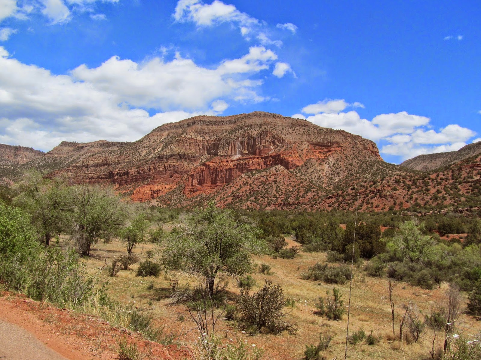
The last stop on this day trip was to Gilman Tunnels which were worth the drive just by themselves. While you're driving to the tunnels, which were blasted in the 1920s, you get a great view of the Jemez Mountains which you can see in my photos below. Once you actually reach the tunnels, you'll get a incredible view of the Guadelupe River which may induce vertigo if you're not comfortable with heights (the road is narrow and in some areas is a sheer drop off). You can learn more about the Gilman Tunnels here.




The following day brought us to Petroglyphs National Monument - or, specifically the inactive volcanoes that are responsible for the lava rock found in the surrounding areas. This portion will be coming up in part two of this post, so stay tuned!
We managed to make an entire day trip out of visiting the greater Jemez Springs area. The drive from the Rio Rancho area to Jemez Springs can be mundane in a few spots, but once you get close to Jemez, you enter the Santa Fe National Forest and the surroundings become saturated with beauty. As you travel through this area you can't help but feel as though you're on the set of a classic American western movie. It doesn't get any more authentic than this. Also, as you're driving through the Jemez Pueblo you can get a small glimpse into the Native American lifestyle which is interesting to see.
While in Jemez Springs we stopped by the Jemez Historic Monument which only takes about 30 - 45 minutes to walk through. I can't say there is anything too highly entertaining about this monument but it is always interesting to see historic ruins. For more information on the monument check out this website which gives a detailed history.
The last stop on this day trip was to Gilman Tunnels which were worth the drive just by themselves. While you're driving to the tunnels, which were blasted in the 1920s, you get a great view of the Jemez Mountains which you can see in my photos below. Once you actually reach the tunnels, you'll get a incredible view of the Guadelupe River which may induce vertigo if you're not comfortable with heights (the road is narrow and in some areas is a sheer drop off). You can learn more about the Gilman Tunnels here.
The following day brought us to Petroglyphs National Monument - or, specifically the inactive volcanoes that are responsible for the lava rock found in the surrounding areas. This portion will be coming up in part two of this post, so stay tuned!
Monday, October 6, 2014
Corrections is a thankless job

By the way - I'm not saying we as corrections officers *need* to be thanked or recognized for what we do... But it would be nice once in a while.
Friday, September 26, 2014
I'm not impressed by Ello or their "manifesto"

Today I've been seeing the term 'Ello' all over my Facebook feed, and I just discovered it's a new social network being touted as the "Anti-Facebook."
On their website, they list a manifesto (ooooooohhhh!) and declare their service "Simple, beautiful & ad-free." However, in 2010 MetaFilter user blue_beetle made a comment that would be literally be circulated around the Internet millions of times: "if you're not paying for something, you're not the customer; you're the product being sold." Think about it - how can a service as Tumblr or now Ello be completely no-cost and ad-free? Surprise! They sell your information to advertisers.
As for Ello, I don't think I'll be quick to register an account. It seems like a counter culture social network trying too hard to be about.me or Tumblr - and what's with that hideous courier font? I'll pass.
These companies trying to reinvent the social network wheel are failing to realize one massive aspect of Facebook: Everyone and their mother are on Facebook. My 65 year old mother is active on Facebook and even uploads photos with witty comments from her iPhone. We have almost a decade of memories, photos, and stories on Facebook. Why would I throw all that a way for a new service which none of my family is using or will ever use?
Saturday, September 20, 2014
Panoramio Will Be Replaced By Google Maps Views
After starting several discussions in various Google Groups and pestering the devs on Twitter and Google+ (sorry guys!), I've finally gotten some clarification on what will be happening to Panoramio. Last week Google announced that they would be expanding the Maps Views service to include geotagged photos. This immediately made me wonder what would happen to Panoramio, a photo sharing and geotagging service acquired by Google in 2007.
Product manager Evan Rapoport recently posted in the Panoramio support forum, saying this:
So, we will have to wait and see how this one plays out. I predict Google will continue to bolster Google Maps Views and will isolate Panoramio as a standalone service that may or may not die out some day.
Product manager Evan Rapoport recently posted in the Panoramio support forum, saying this:
Over the past year, we've developed a similar community in Views, which lets you publish geo-relevant content (photo spheres and traditional photography) on Google Maps. In the future, we plan to migrate Panoramio into Views, creating one destination where you can publish and peruse imagery from around the globe. Before migrating any imagery, we'll make sure that Views reaches a level of feature maturity that supports the needs of the community.
So, we will have to wait and see how this one plays out. I predict Google will continue to bolster Google Maps Views and will isolate Panoramio as a standalone service that may or may not die out some day.
Sunday, September 14, 2014
Panoramio vs Google Maps Views
I just tried to start a discussion on the Google Maps Views community page:
Note: I've tried posting this same question in many different arenas and have gotten no help whatsoever. Here are the links to those threads:
Panoramio Support Forum
Google Maps Support Forums
Google Maps Views Community
Google+ Support Community
I've even tweeted some of the developers behind Panoramio and Google Maps and have not gotten a reply from any of them.
So now that Google Maps / Views is displaying your public geotagged photos, it begs the question - what purpose does +Panoramio serve? Both services include your photos in Google Maps so what happens if you upload the same photo on Panoramio and Google Maps? Which photo does Google show?
AAHHH these are the questions that infuriate me. Why does Google have to have so many duplicate and/or overlapping services?
Note: I've tried posting this same question in many different arenas and have gotten no help whatsoever. Here are the links to those threads:
Panoramio Support Forum
Google Maps Support Forums
Google Maps Views Community
Google+ Support Community
I've even tweeted some of the developers behind Panoramio and Google Maps and have not gotten a reply from any of them.
Subscribe to:
Posts (Atom)